Wiggle Watcher World Activities
NOTE: Use of these activities is free for all teachers in Lincoln County, Oregon. For information on how to checkout an activity, click HERE . |
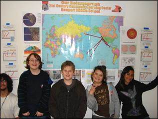
Section 2: Where in the world are we?
Introduction to maps , reading contour maps, map projections, latitude and longitude, and GPS. All culminating in the mapping of earthquakes.
ACTIVITY #02-01: Understanding Mapping Projections with balloons
The world is round but our maps are flat! So how do scientists make flat maps? A simple balloon works wonders as a demonstration. Blow up the balloon and draw similar sized circles on the inflated balloon. After deflating, the balloon is slit down the side and stretched out so it is flat. OHHHH! NOW I understand map projections!
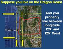
ACTIVITY #02-02: Intro to latitude/longitude and GPS ōBingoö
Sometimes learning latitude and longitude can be really boring. But now do it with GPS bingo and youÆll see the spark of enthusiasm! Each student gets a different piece of the Earth. Call out the locations and youÆll soon hear ōBingo!ö
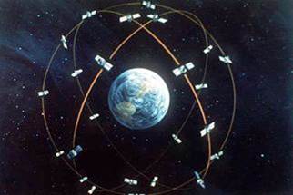
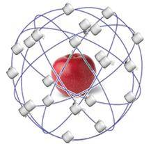
ACTIVITY #02-03: An introduction to GPS
A PowerPoint slide show introduces GPS and how it works. Then pass around an apple, toothpicks and marshmallows and let the students build their own system of positioning satellites around their ōEarthö.
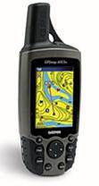
ACTIVITY #02-04: Using a hand-held GPS locator
This activity is done outdoors (of course). Flag a few locations in your playground and have the students record the lat/long coordinates for each. Then go back to the classroom and see how everybody did. Four GPS devices are provided, with simple instructions for each.
What a fun adventure!
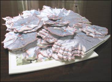
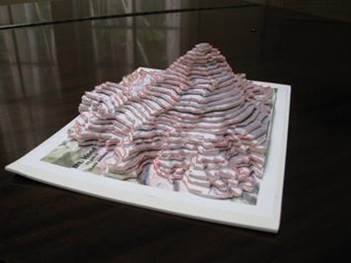
ACTIVITY #02-05: An introduction to Contour Maps
It is surprising how many people canÆt read a contour map. But youÆll have expert students after this activity. Using foam sheets, each students cuts out their contour piece. And when you assemble them all together, youÆve conquered the mountain ¢ Mt. Hood that is!
ACTIVITY #02-06: Map that Earthquake!
Now that we know maps, lat/long coordinates and GPS methods, we can keep track of earthquakes on our own earthquake map!
For information about this website, contact kwyatt@geocouple.com